Making my way back towards Medellin (very slowly and circuitously) I was heading down to near sea level again. And once more it was becoming uncomfortably hot.
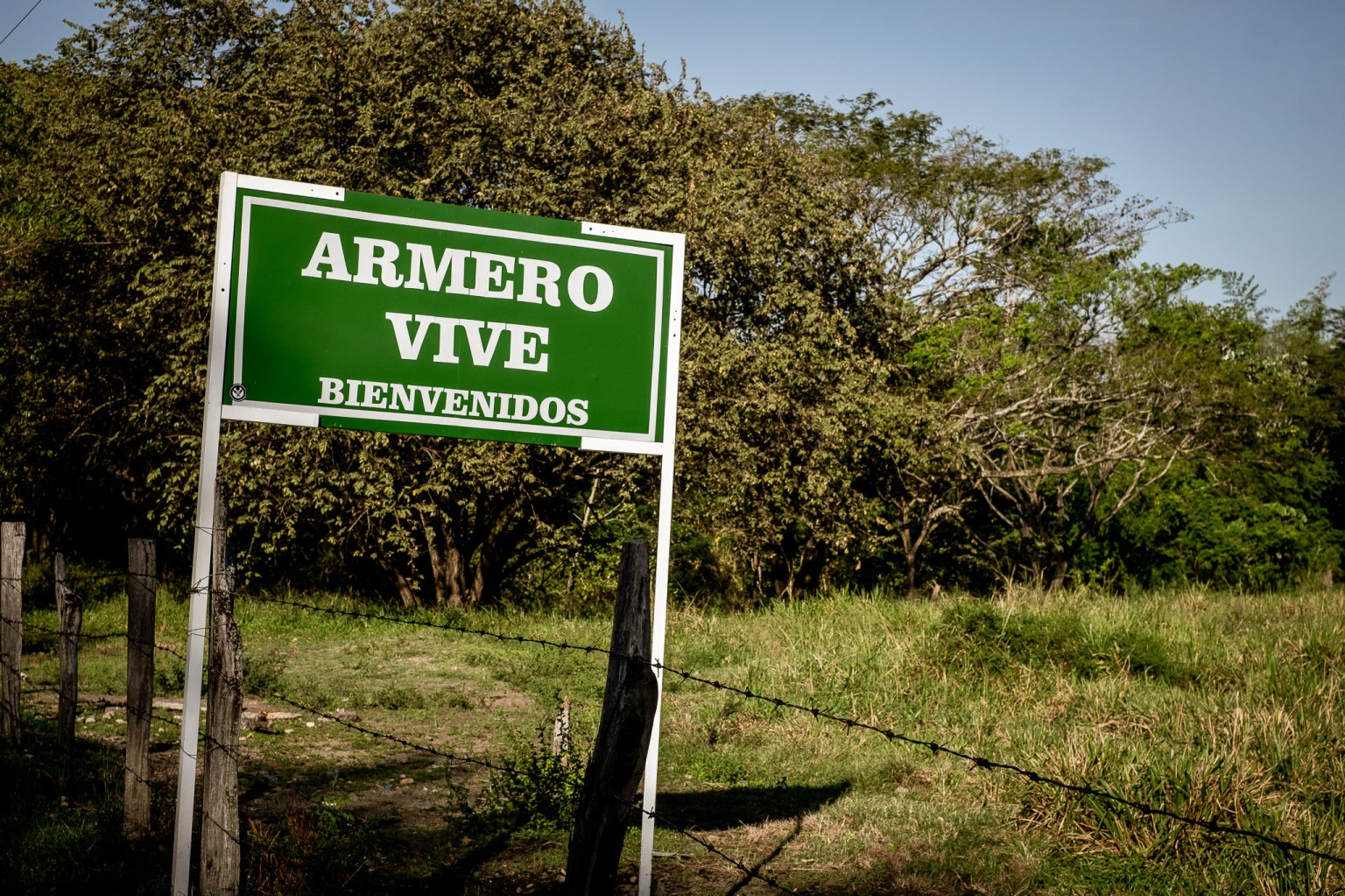
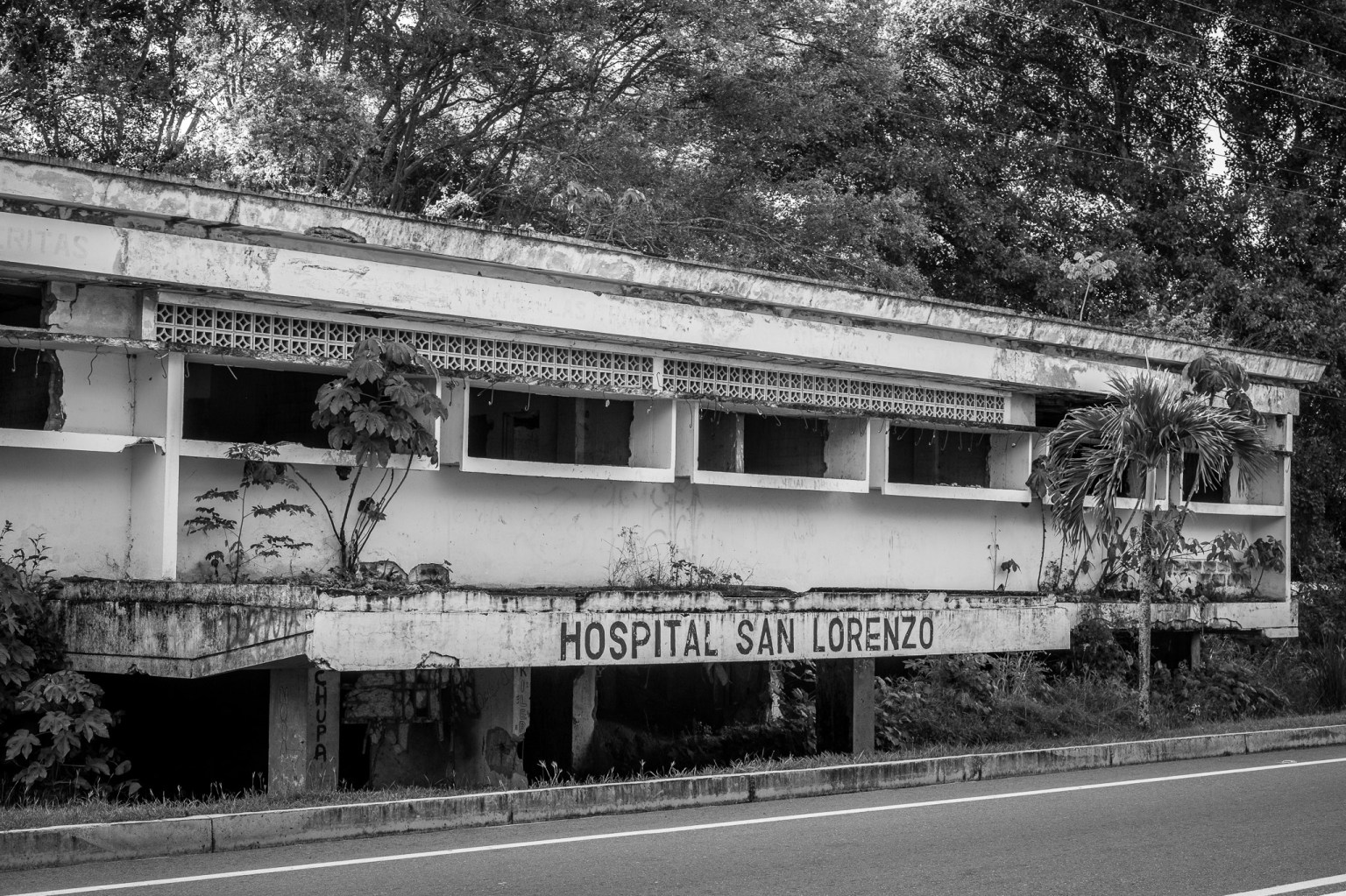
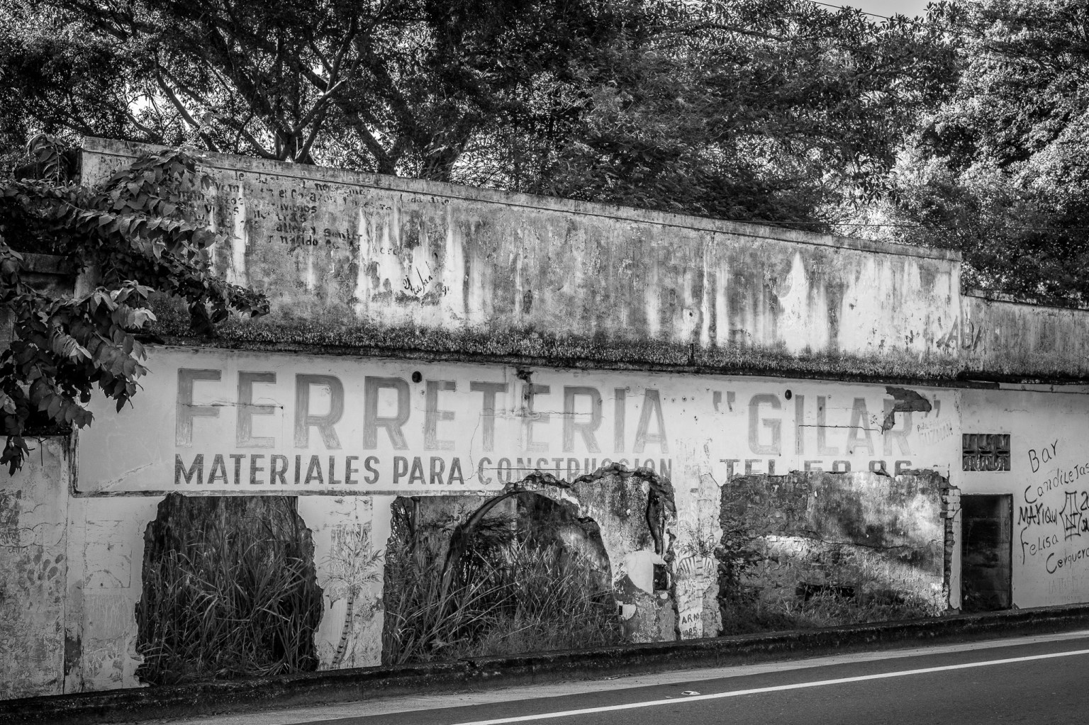
Having previously been told by a taxi driver about the tragedy of Armero, I wanted to visit the town. Thousands died here after the eruption of the volcano Nevado del Ruiz on Nov 13th 1985. The sea of sludge engulfed the town, killing over 20 000 (more here).
As you ride into the town you come to the welcome sign saying ‘Armero lives’ before passing ruins that show all too clearly the impact of the flows.
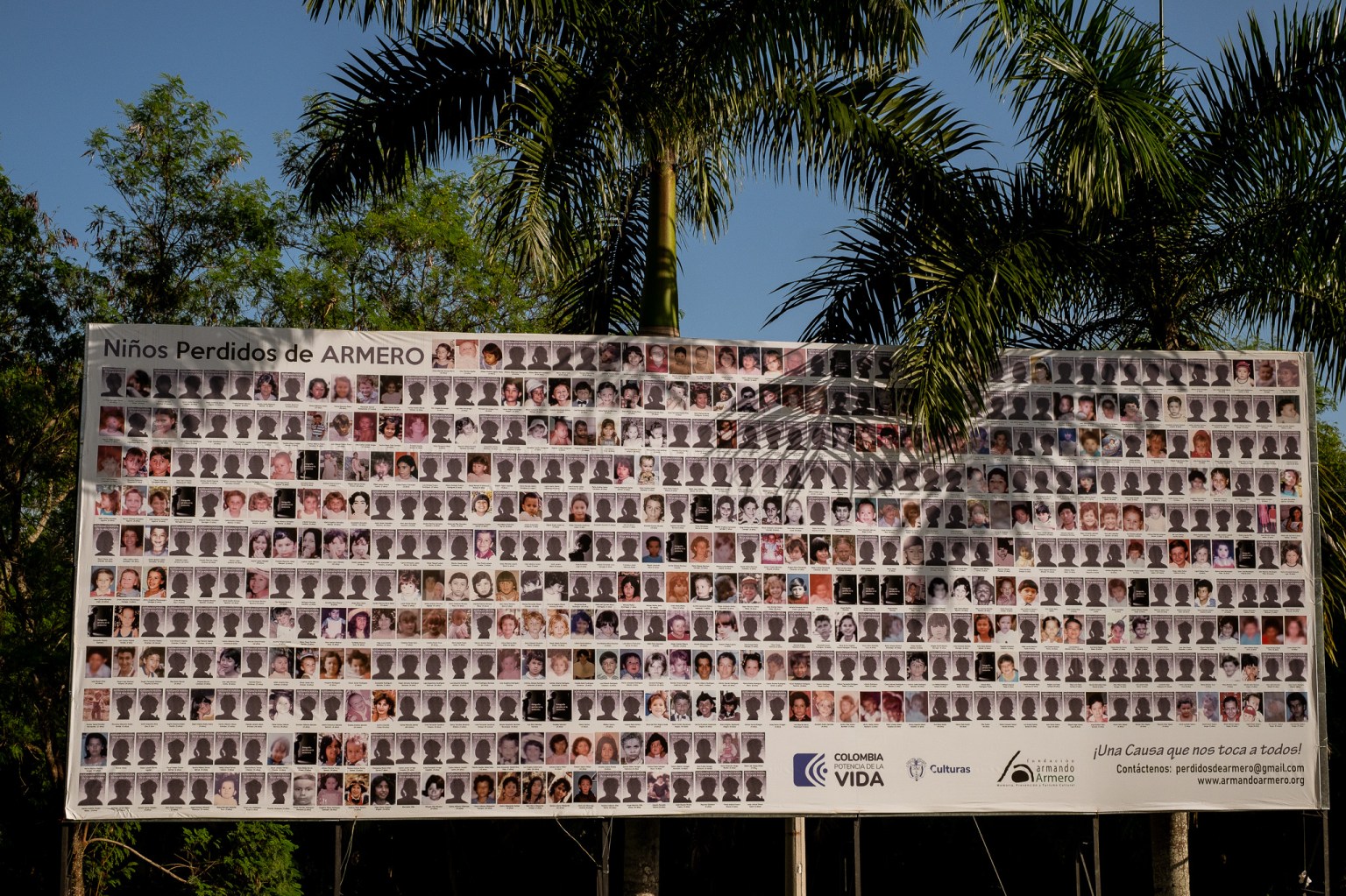
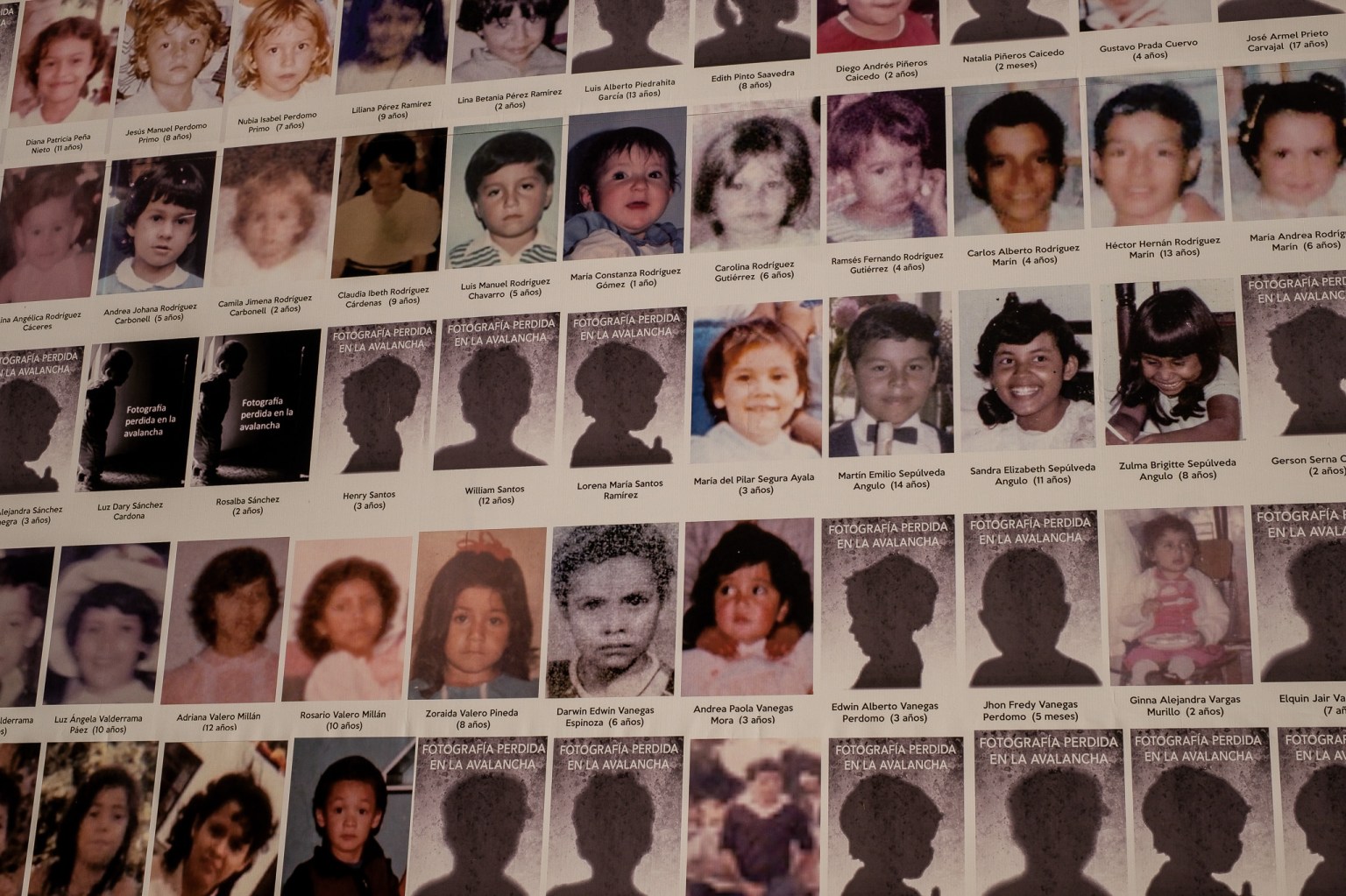
You also come face-to-face with a giant billboard asking for help in discovering the fate of ‘the children of Armero’. Apparently in the chaos of the aftermath, record-keeping of surviving children was poor. Consequently some families have never found out whether their children perished or were given up for adoption in Colombia or abroad. On the billboards many pictures are silhouettes as the only photographs of the children were also lost in the tragedy.
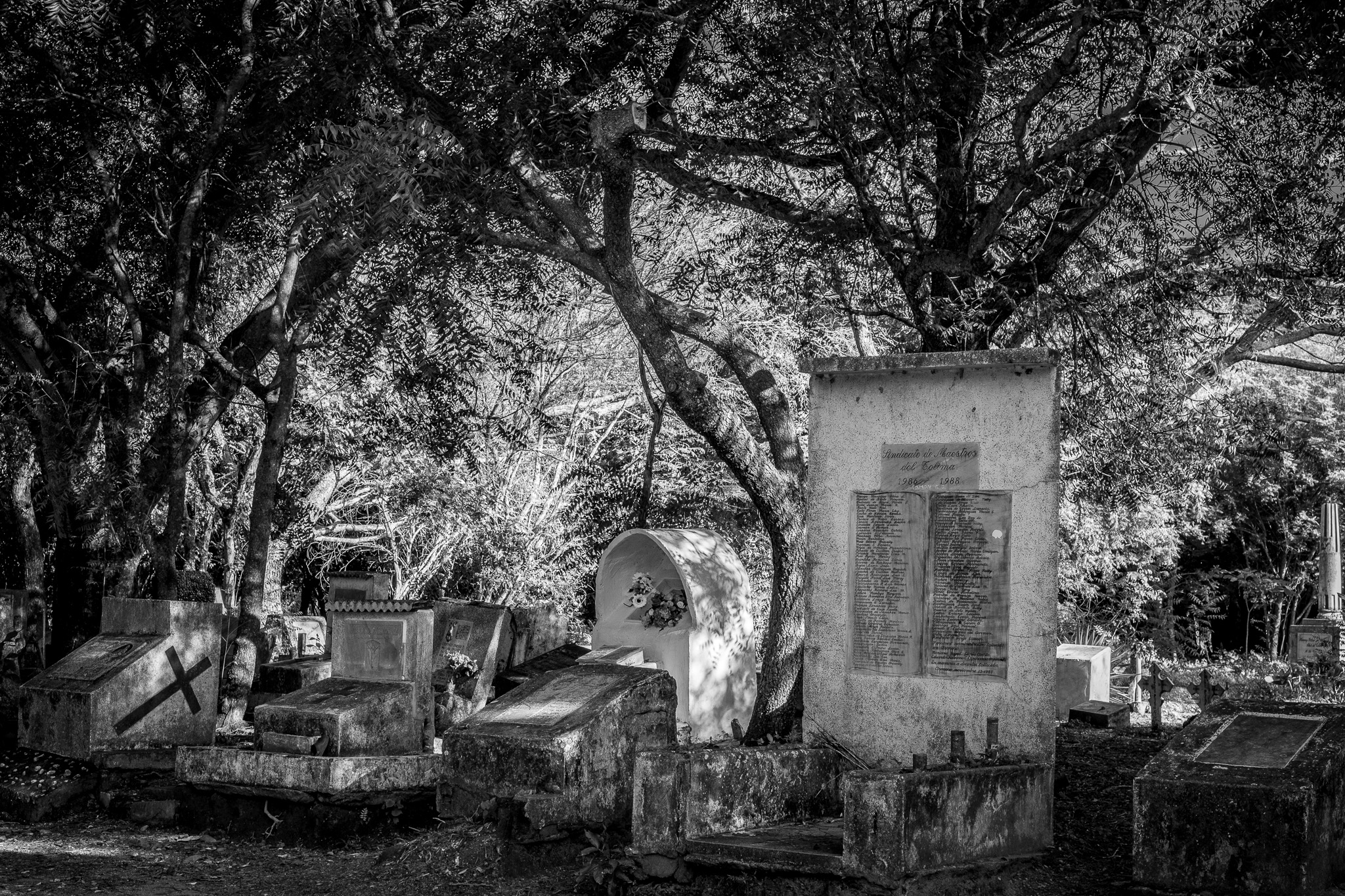
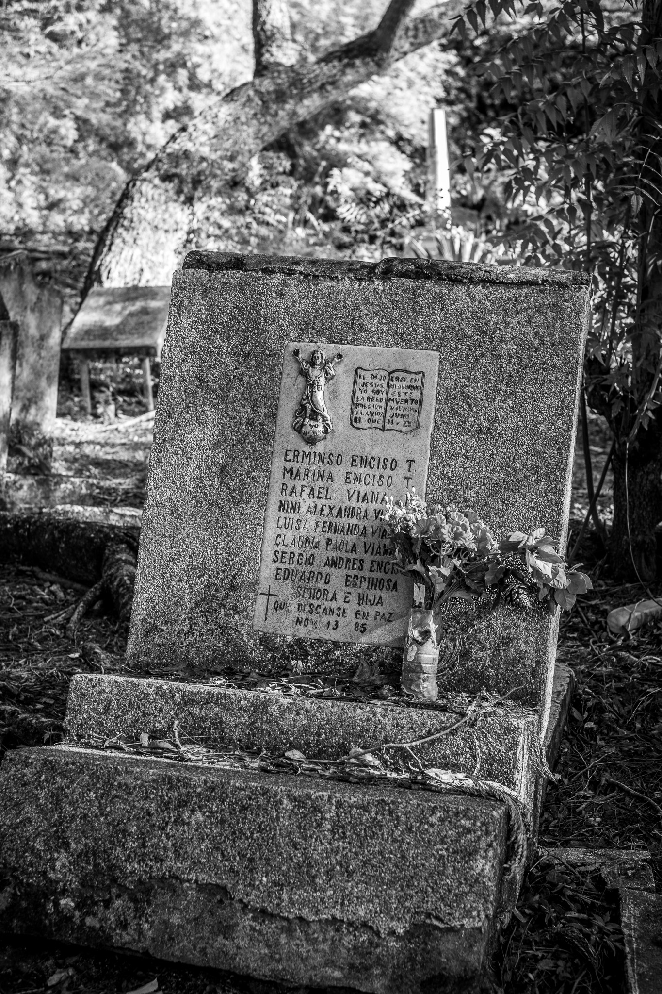
The rebuilt village is set apart from the old site. Where houses used to stand there are now gravestones.
It’s chilling to see names of several generations of a family on a single stone with the same date of death.

I had read that there was a museum in the village dedicated to the events and specifically the memory of Omaira Sánchez, a young girl who became a symbol of the tragedy when a picture of her, almost completely buried but alive, went around the world. She was trapped under the water and attempts to rescue her failed. The photograph intensified the debate around the adequacy of the government response, as well as the nature of photojournalism.
Sadly I was told that the museum had been closed apart from special events for two years. Having already booked a hotel for two nights, I had a day in this village that has such a heavy history. Not sure whether caused by the history, the heat, or something else, but it was the only village in my travels where I felt uncomfortable; the atmosphere was oppressive.
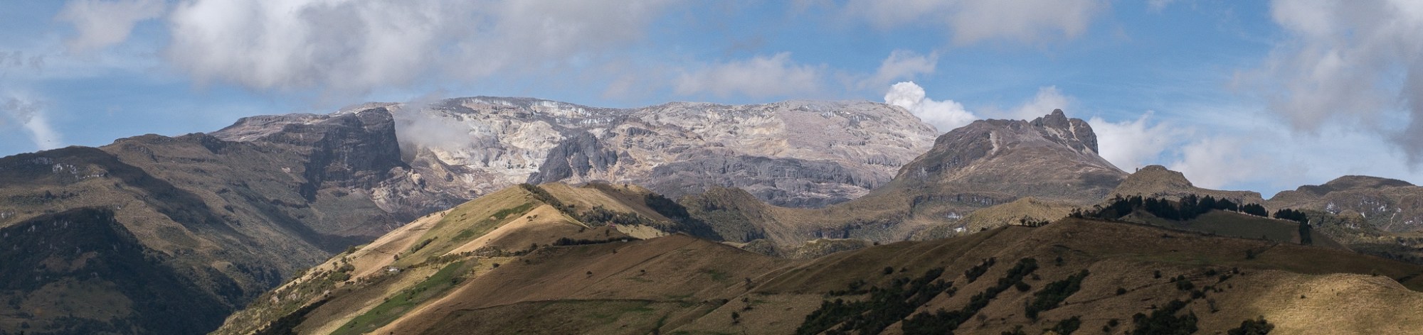
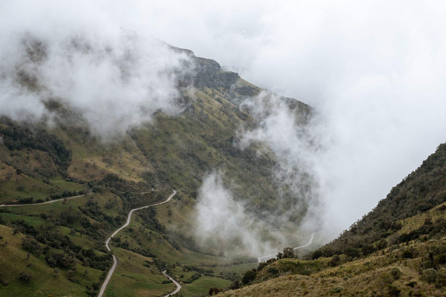
Thoughts of Armero stayed with me during the subsequent spectacular ride over the volcano, taking Colombia’s highest navigable road at 4150 metres. The summit of the road was some 90 kilometres from Armero. Thankfully there were two villages conveniently placed so that I was able to split the long steep ride ‘over the top’ into three manageable segments.
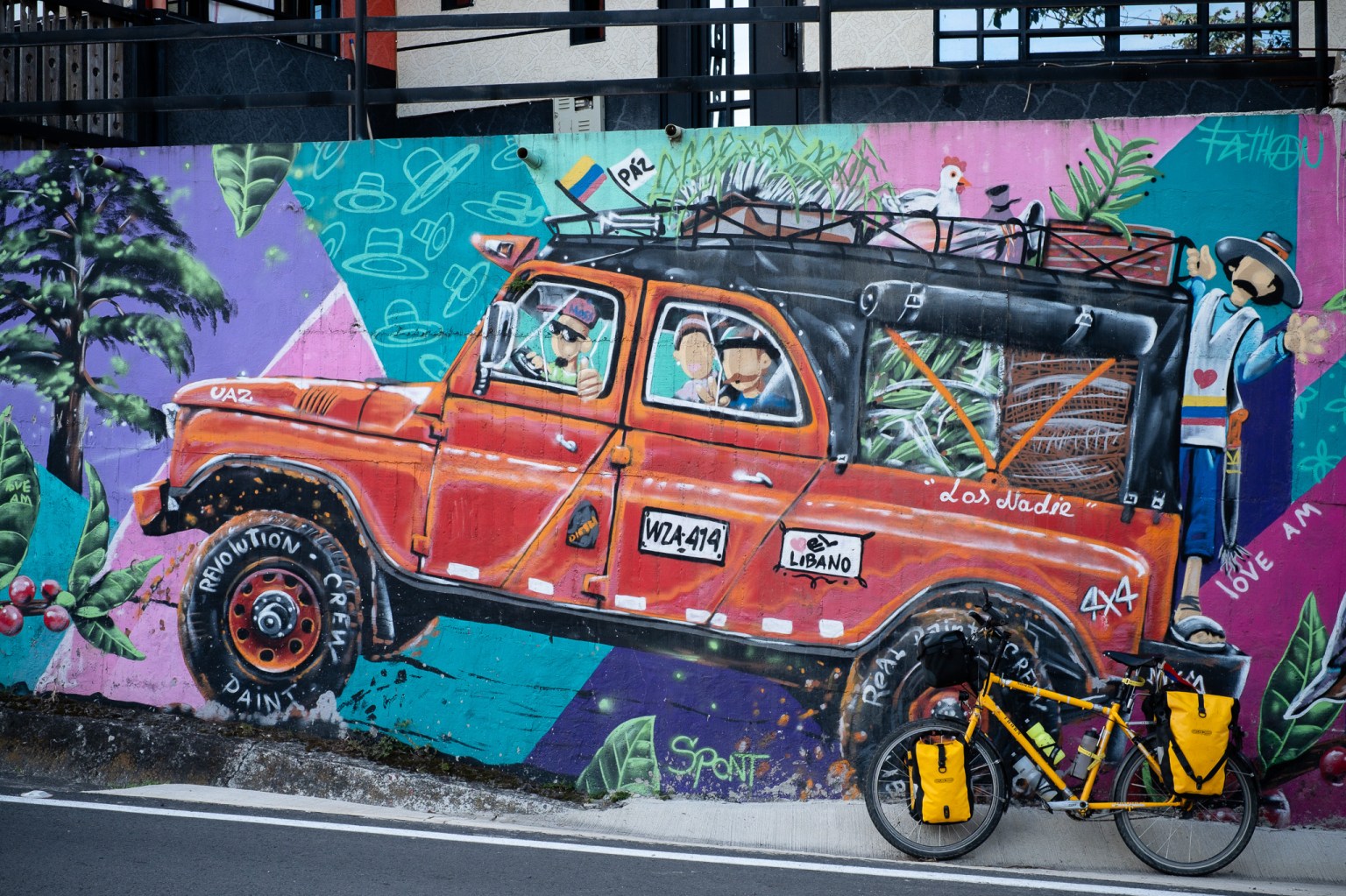
The first village I came to, Libano, was straight back to colourful and happy Colombia.
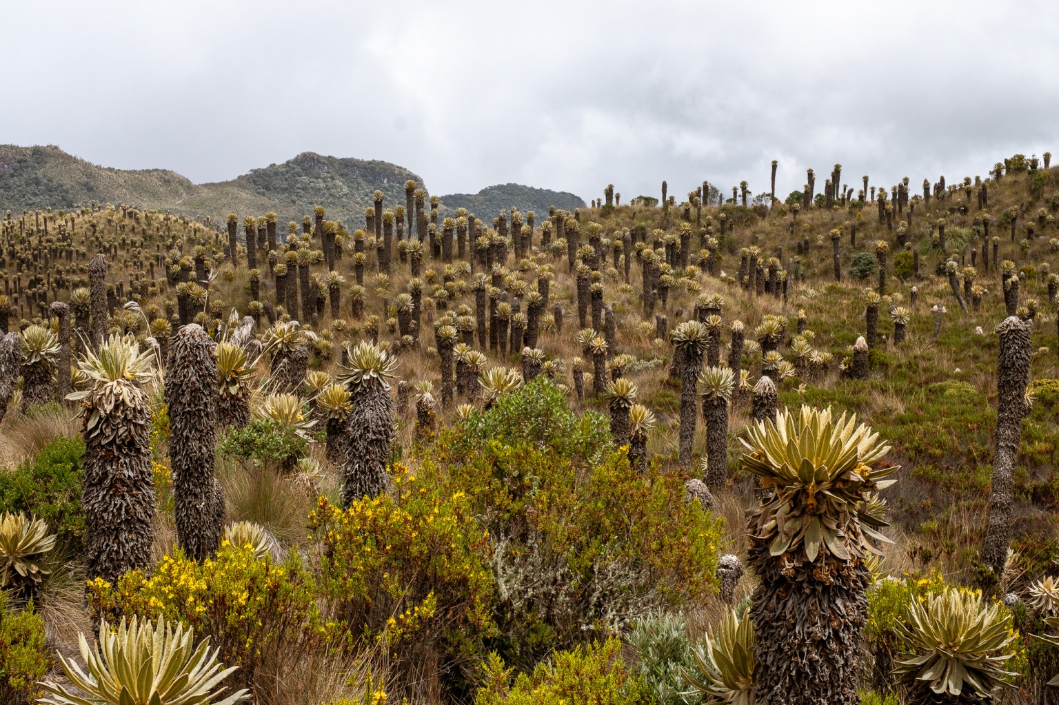
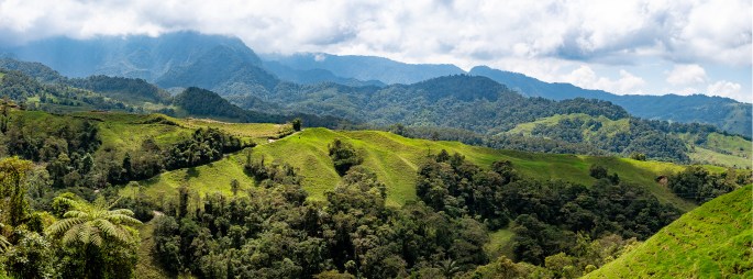
At altitudes of over 3000 metres you’re in the ‘Paramo’, the unique ecosystem of the high Andes. Apparently over half the world’s Paramos are in Colombia, covering 2.5% of the country’s surface. They are also known as ‘Cloud forests’ as they are often shrouded in fog. My ride over the top was no different.
Not only do you get short of breath at this altitude (and if you’re really unlucky, a stinking headache) but you also get to see unique plant and wildlife.
The most striking feature are the ‘frailejones’ plants, that look like tall furry cactus plants.
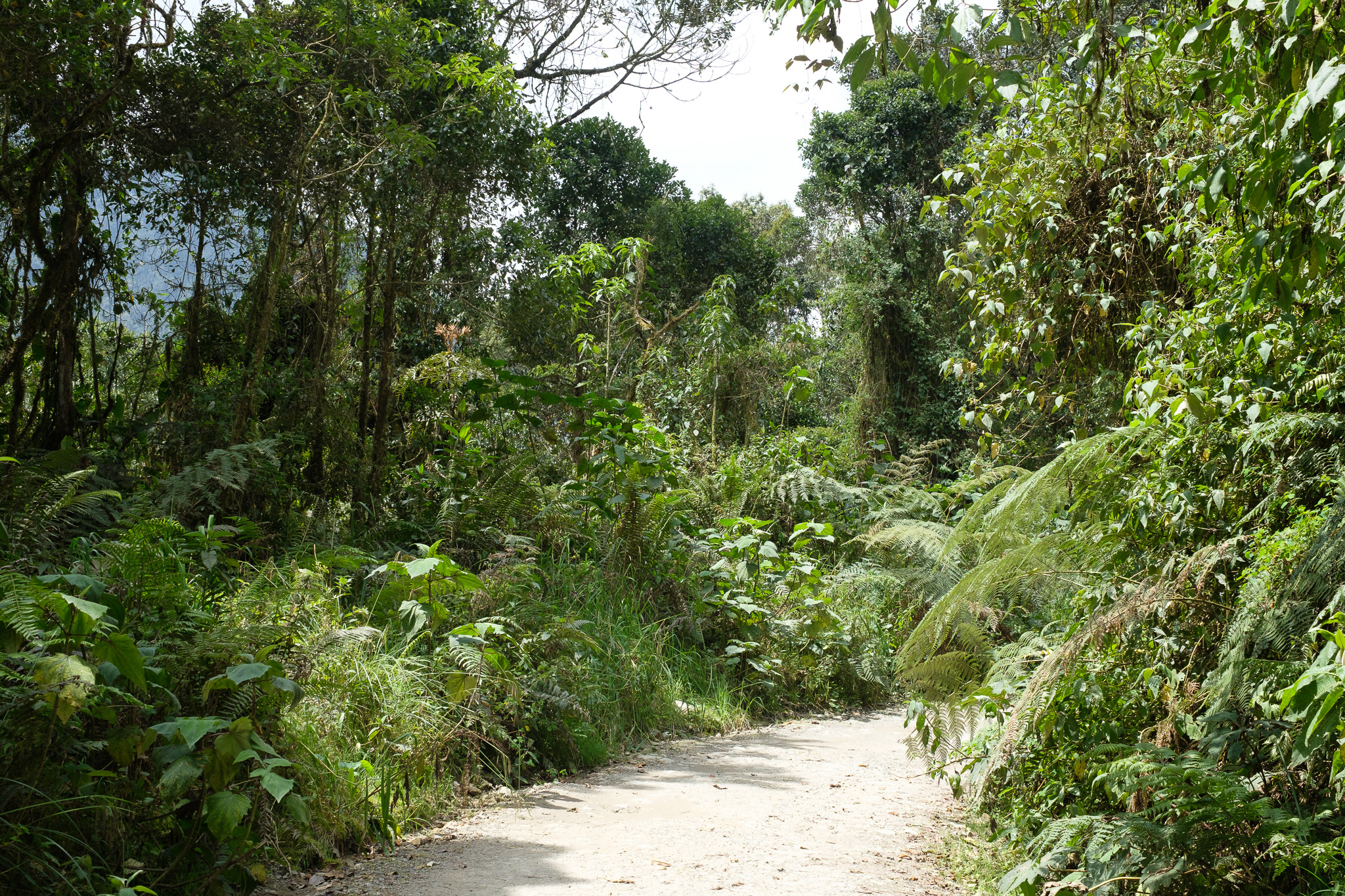
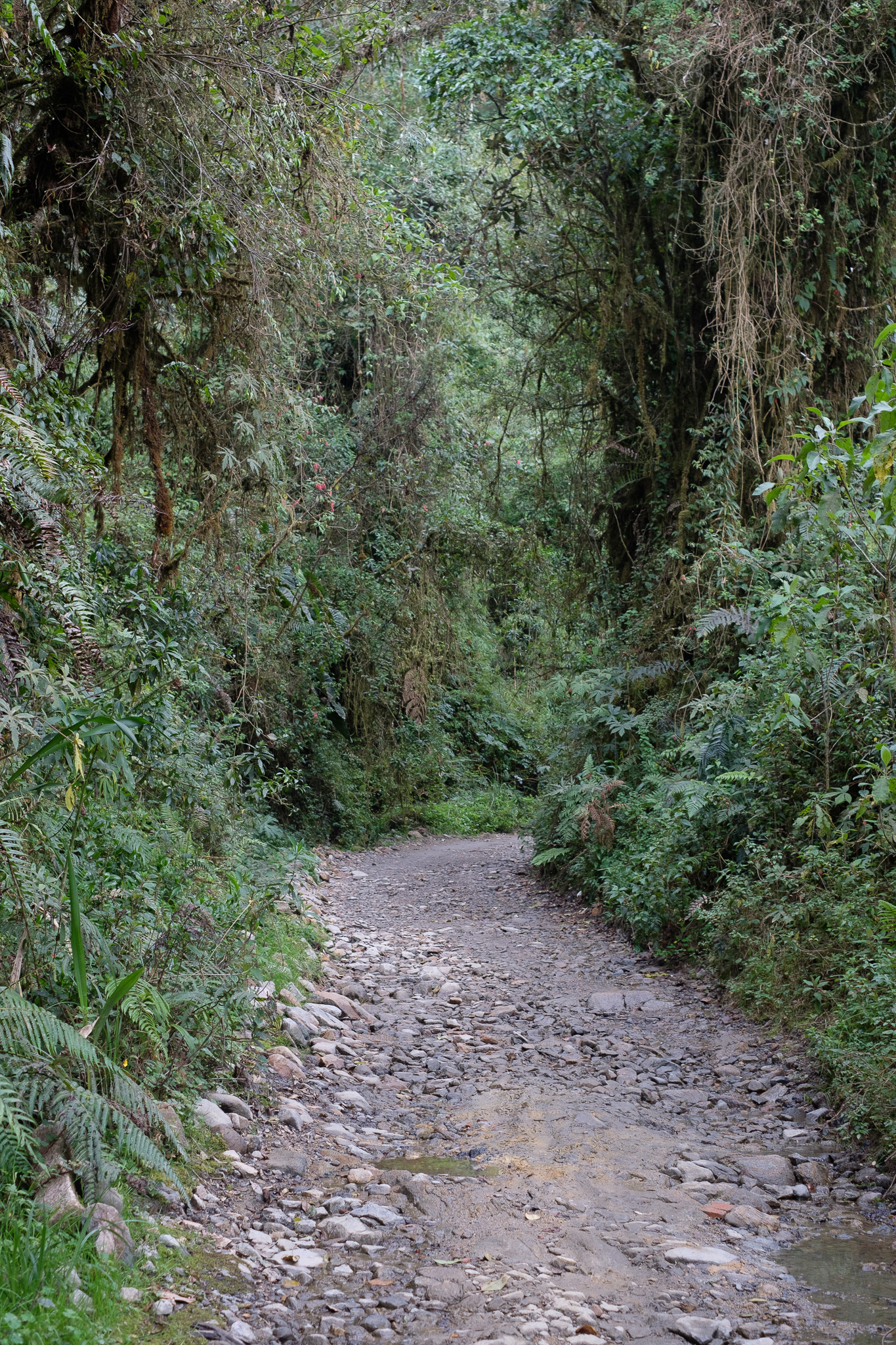
On the way down the other side I was treated to a stunning descent through a few kilometres of rain forest in the national park before emerging into rolling hills again. Going down a very rocky path I was glad to be going down rather than climbing. And grinning all the way at how exceptionally beautiful the ride was.
I’ll sign off by wishing all of those celebrating a Happy Easter. Hope everyone is well, wherever they are in the world!
Stuart
